IYPE Hungarian Opening as civil initiative
Even results of satellite based radar interferometric (PSInSAR) survey case were introduced. Images: HUNAGI Visuals resource, 2008

PopularGeosciences
The 4-day interactive exhibition devoted to the Geosciences and the International Year of the Planet Earth attracted about 6000 visitors last week, mainly school groups and families.
HUNAGI proposes to its members to select the IYPE goals (www.yearoftheplanetearth.org) as main topics for the domestic events of the International GIS Day 2008 celebrated in mid November.
Lectures and Exhibitions with field training in Budapest between April 17-20
The 4-day interactive exhibition devoted to the Geosciences and the International Year of the Planet Earth attracted about 6000 visitors last week, mainly school groups and families.
In the field of geography, cartography, thematic mapping, geoinformatics and Earth observation the following institutions attracted the visitors: ELTE TTTT, FÖMI, OMSZ, MTA TAKI, MTA GGKI and MAFI, all members of HUNAGI. Interesting pilot project using novel PSInSAR technology to detect surface movements was displayed as a joint work of ELGI and FÖMI. Opening of the event was participated by Prof. de Mulder, International Program Director of the nternational Year of the Planet Earth. Photogalleries of the event are accessible here by clicking the cover images below:
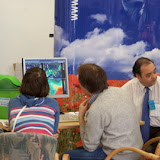 |
| IYPE (Földév) Exhibition - a weekend look around |
and
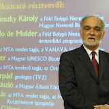 |
| IYPE Hungarian Opening Event |
posted by RFG @ 09:20
![]()
![]()


0 Comments:
Post a Comment
Subscribe to Post Comments [Atom]
<< Home